Here is the map from the Plymouth Chamber of Commerce site (the map I printed out was a bit more readable):

I parked at the Senior Center, a restored railway station

More detail, Built 1911, Restored 1993

I found this postcard, from about 1912, on Wikipedia

I walked along Green Street looking for some signs, and found none. So I entered the Senior Center and asked if anyone knew anything about the trail. Sure enough, I was given a much larger map, and some directions to get me started!
Just before Green Street joins Main Street there was this interesting historic marker

Beyond the bridge was another marker

and, just after it, the restored building

Near the Armory I saw an interesting sign that I had never noticed while driving past it
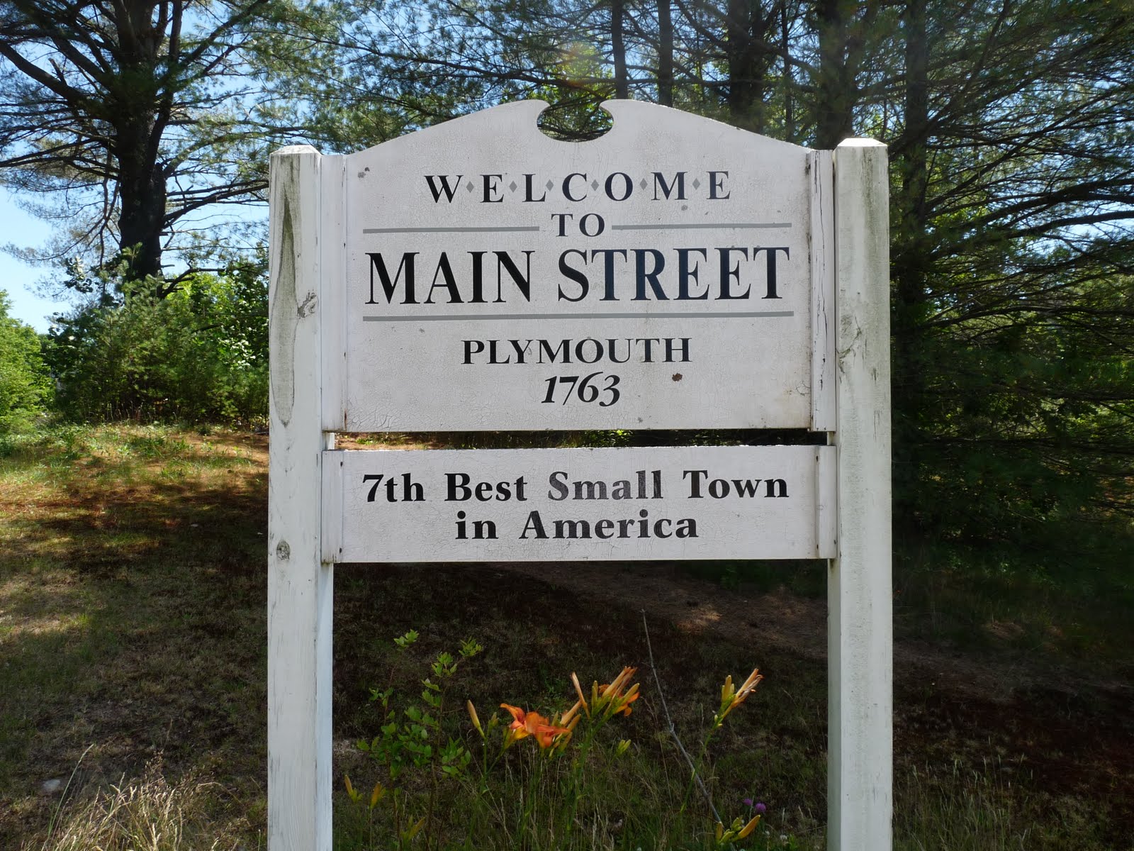
I was obviously intrigued about the ranking, Google quickly led me to the list: 100 Best Small Towns in America, and to the book: 100 Best Small Towns in America. Shortly after the armory I came on a big open space, which contained the Plymouth community gardens, "GARDENS for all of PLYMOUTH" as the sign says.

Beyond the community garden a wide trail enters the woods. According to the map the wooded area (or at least part of it) is Langdon Park, which belongs to Plymouth State University, but is obviously open to the public. The first few paragraphs of Langdon Woods: A Deeper Shade of Green at PSU are the only item I have found on the web about this park.
The trail follows the south bank of the Baker River,

at times very close to the river.

After a while the wide path skirts the edge of a large field.

After reentering the woods the trail forks; one day I may want to explore the other trails

Beyond this the trail passes through a fence and narrowed, becoming more like a hiking trail than the carriage road it had previously been. I assume that this fence marks the boundary of the park, and that the area beyond is private land.

Here is a nice view of the river and the highway on its other bank

Beyond that I came to a sign pointing left (south) to a rough trail at right angles to the river.

My map showed that this would soon lead to the high school and a major road. I decided to forgo the Heritage Trail and follow this riverside trail as far as it went. It continued along the river until a small rise showed me a familiar view; the gas station and Dunkin Donuts opposite the Hatch Plaza.

Sure enough, after a few steps the path passed through a field of ferns to reached the easternmost edge of the plaza.

I retraced my steps to return to my car after a very enjoyable walk, largely in the woods.
My recommendation would be to start this walk at the Hatch Plaza, and only continue to Rt. 3. The section from the Senior Center to the community garden is along Rt. 3, a busy highway with little to recommend it This gives about 1½ miles each way, almost entirely in the woods. Here is a picture of the start of the trail as seen from the parking lot.

Rather than map my trip as I did it I am showing my recommended hike from the Hatch Plaza to Rt. 3. This is a fully interactive Google Map. You can zoom in or out, pan, and by clicking on the parking icon you can get directions to the trailhead.
I returned on July 5 and explored some of the side trails, many of which lead to the high school. If I decided to post any photos I will make a new blog entry; right now I have just updated the map to show the additional trails.
Map
View Trail along Baker River in a larger map
Hey there,
ReplyDeleteI always use your hiking site as a reference and had never clicked over to the blog before now. What a coincidence, you just went hiking around Plymouth, my hometown!
I live in Pittsburgh now and will be coming back next week to do some hiking... I was thinking Tripyramid or Carrigian. Anything with rock/ledges/ridges always works for me, and cool streams and such are a nice bonus too!
Let me know if you have any other recommendations - love the site, keep it up