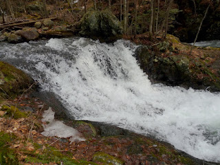
Last year I first read about the Brook Walk, a delightful trail that follows a part of Shannon Brook with many cascades and waterfalls, and I often incorporate it into my Mount Roberts hike.
Last Monday (3/19/2012) I was returning to Thornton from Boston. Feeling too tired to hike Mount Roberts I decided to do a loop including the Brook Walk, and take my time taking photographs. Most of the photos are from that day, though I have included a few from other trips.
Map
This is a fully interactive Google Map. You can zoom in or out, pan, switch from map view to satellite view, and by clicking on either of the parking icons you can get directions to them.
View Larger Map
I parked, as I almost always do, at the lower parking lot on Rt. 171. It is huge; I assume that it sees heavy use by snowmobilers in winter:
Just outside the parking lot is a kiosk with a map of the area:
and the first of many trail signs:
The Brook Walk drops steeply and crosses Shannon Brook on a bridge just upstream from its junction with the tributary (I would guess that the tributary is somewhat larger than Shannon Brook). I followed a path downstream a bit and got this photo of the junction (tributary to the right):
Almost immediately upstream from the bridge is the most impressive of the falls; Falls of Song. Each of the major falls has an interpretive sign, with an old picture and explanatory text:
The falls now:
The Brook Walk then follows the brook upstream, passing by a total of six named and signed falls. Next up are the Bridal Veil Falls:
Just below the Bridal Veil Falls was the only ice I saw:
Next up is Emerald Pool and Emerald Pool Falls:
The falls from downstream:
and the pool from upstream:
Beyond them is an unnamed cascade that seems worth noting:
On my two March trips I somehow completely missed the Twin Falls (often called 7 cascades, as they are a series of cascades)
Here is the most impressive of the cascades that make it up
Here is the most impressive of the cascades that make it up
Finally I reached the last set of falls, Roaring Falls, which are the only ones that still have a bridge across them (though views are much better from below the falls):
The falls
I crossed the bridge and had lunch near Shannon Pond, which still had a partial ice covering:
A couple of notes. On my way in I met three women who live in the area; they told me that the water was quite a bit lower than it had been earlier in the season, but was still quite high. I have never really timed my trips to coincide with peak high water, but hope to do so either after a big storm or at the peak of next year's snow melt.
For photographers I will note that the banks of the brook are very steep, and that I did not feel comfortable going far off trail. There were several places where I longed to get closer to the brook for better views, but did not feel it was safe.
For photographers I will note that the banks of the brook are very steep, and that I did not feel comfortable going far off trail. There were several places where I longed to get closer to the brook for better views, but did not feel it was safe.


